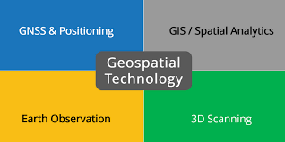
What is Geospatial Technology?
Geospatial technology is a growing field that utilizes computer technology to create maps and analyze data. This technology has many applications in a variety of different fields. Here, we’ll examine its benefits and growth potential. We’ll also take a look at some of the applications of geospatial technology. After reading this article, you’ll have a clearer understanding of how geospatial technology works.
Applications of geospatial technology
Geospatial technology has numerous uses in the world, including helping answer questions about the world around us. Historically, geospatial technology was largely used for cartographic purposes, but its scale and applications have expanded to include other industries. With its ease of use, geospatial technology has become a valuable tool for completing scientific and non-scientific tasks. Its widespread use has been recognized by common people and experts alike, and it continues to grow and evolve.
In agriculture, geospatial technologies have helped farmers understand climate change and manage resources. Accurate yield predictions help businesses and governments ensure food security. Geospatial tools for agriculture have advanced significantly in the past few decades. High-resolution satellite data is used to spot problems in the fields and pinpoint crop progress. The use of UAVs to gather data on crop progress is also becoming more popular. Microwave remote sensing data collected from satellites can also be used to forecast crop yields.
Geospatial technology is also used in the construction industry. It can be used to generate maps of construction sites, so that construction professionals can see progress in the construction process. Geospatial data can also help the construction industry make smarter decisions on how to proceed with a particular project. This technology can also help with waste management and construction safety.
Geospatial technology, or GIS, is a computer system that uses layers of information to map the Earth’s surface. With the help of GIS software, users can view geographic data visually and dynamically. It is used in many applications, including resource management, environmental studies, urban planning, homeland security, military analysis, archaeology, precision agriculture, emergency response, and economics.
In recent decades, the use of geospatial technology has grown tremendously. In addition to helping businesses, it has also helped government agencies streamline their workflows and share geospatial data with a wider audience. By using cloud technology, agencies can easily store, manipulate, analyze, and visualize geospatial data.
Another use for geospatial technology is in the transportation sector. By utilizing geospatial data, businesses can better understand the types of customers they serve. They can also create buyer personas to target specific markets. This data also helps retailers make shipping processes more efficient. This can improve customer satisfaction, reduce shipping costs, and make shipping more accurate. Additionally, geospatial data can help retailers optimize their supply chain process and develop a more sustainable business model.
Evolution of geospatial technology
Throughout history, geospatial technology has advanced humankind’s understanding of its surroundings. From early boundary surveying to topographical mapping, it has been used to better understand complex environmental interactions. Geospatial technology has also revolutionized the transportation industry, transforming route planning, navigation, and location analysis.
Today, geospatial technologies are being adopted in social sectors, including the education, livelihood, and financial inclusion sectors. They are also being used for environmental conservation and natural resource management. In India, GIS technologies are playing a significant role in meeting the UN SDGs, helping to create the survey infrastructure in villages and develop accurate land records. It has even been used to assess the suitability of landscapes as habitat for various species.
The healthcare sector has also benefited greatly from geospatial technologies. The ability to map disease hotspots and make more precise decisions has proven vital. This data also allows city managers to understand trends in health based on location, age group, and disease. Ultimately, this data can be used to plan healthcare interventions.
Geospatial technologies have evolved significantly over the last fifteen years. These technologies are increasingly interrelated and integrated with other disciplines in the information technology industry. Previously, these fields were distinct, but today, they are one. The internet has enabled geospatial technology to become ubiquitous. The growth of geospatial technologies has broad implications for technology and society.
The evolution of geospatial technology is transforming the way we interact with our environment. More governments, utilities, and communications companies are increasingly utilizing geospatial technologies to deliver better information to citizens. For instance, governments can make maps and other information available for citizens via simple websites, reducing the need for staff in town offices. Meanwhile, utilities can allow their customers to pay for their services online. The future of geospatial technologies will be characterized by increased harmonization and integration of geospatial data.
The evolution of geospatial technology is accelerated by academia. Academics and other professionals who study geospatial issues need to adopt new technologies and standards. For example, the Federal Geographic Data Committee (FGDC) developed a new standard called the National Spatial Data Infrastructure (NSDI). This standard is now part of geospatial technology vocabulary. Meanwhile, the Open Geospatial Consortium (OGC) has been formed with the goal of creating consensus IT standards in geospatial data.
Benefits of geospatial technology
Geospatial technology is an emerging technology that improves the quality of business data. It also improves communication channels and allows for better engagement with a wide range of stakeholders. The use of maps and 3D representations of geographic data is closely aligned with stakeholder engagement. Geospatial technologies are gaining ground as they continue to become cheaper and easier to use.
Geospatial technologies are being used in many industries, from automated driving directions to metadata for social media sites. These technologies can improve efficiency and reduce costs in a variety of industries. In agriculture, geospatial tools can help determine which crops to plant and where to plant them. Another application for geospatial technology is in the management of water and land resources. In this way, precision farming can be improved.
Geospatial technology can improve the quality of life for everyone. The ability to analyze the features of the earth makes it easier to plan and implement solutions for a wide range of needs. This technology also helps scientists create maps and track the evolution of landscapes. This technology can lead to better decisions and increase public safety.
Geospatial technology is a critical component of studies in the geosciences. It helps fill gaps in knowledge and helps answer complex questions. Its uses include remote sensing, satellite images, and GPS. It can be used to help fight climate change, protect natural resources, and even improve humanitarian aid.
Geospatial technology can also be used for risk-based insurance. By mapping crime rates, natural calamities, and outbreaks of contagious diseases, insurance companies can better understand the risk factors affecting specific communities. They can then warn policyholders about the risks associated with specific locations. Furthermore, using such technology can help insurers set insurance fees based on risk level.
Geospatial data can also help government agencies better understand their counterparts’ efforts. With better coordination of efforts, government agencies can create more effective programs. Geospatial data is becoming more widely used, not only in disaster management, but also in network planning and asset management.
Growth potential of geospatial technology
Geospatial technologies play a pivotal role in governance. Geospatial data is a necessity for development works across all sectors. With the government aiming to make India self-reliant in space and technology, geospatial technologies are an excellent choice. Moreover, geospatial technologies are aligned with the national vision for a five-trillion-dollar economy.
The geospatial industry is changing rapidly. By 2020, geospatial technology is estimated to contribute USD 2.2 trillion to $5 trillion to the global economy. By 2030, this figure will reach $30 trillion. However, the geospatial industry is still in its early stages. While the industry is growing and developing, it has several challenges and opportunities ahead of it.
Today, large, multinational technology companies have entered the geospatial space. The acquisition of Waymo by Google and the launch of Google Maps show how important geospatial technology has become. Even Microsoft has entered the geospatial space, experimenting with virtual earth in 2003. It has also invested in high-resolution digital cameras and acquired Vexcel.
Aside from helping create intelligent maps, geospatial technology is also used for social investigations and policy-based research. It can help researchers and advocates identify spatial patterns that are hidden in large volumes of data. In addition, geospatial data can help make decisions in a more efficient way.
North America is currently the largest geospatial market. The region is highly open to geospatial technology and is projected to grow at the fastest rate in the next few years. Geospatial technology is widely used in transportation, agriculture, and utilities. The growth of mobile GIS technologies is expected to accelerate geospatial analytics in the region.
The geospatial industry is one of the fastest-growing industries in the world, according to a report published by Research and Markets in January 2021. Its expansion will be driven by new innovations and fundamental improvements in GIS software. The rapid evolution of technology will require an accelerated training schedule and increased awareness of privacy and cybersecurity issues.
The COVID-19 pandemic, which slowed down global business operations, has also increased geospatial analytics adoption in various sectors. For example, it is now possible to identify the locations of hot spots for cholera. By using geospatial and location-based technologies, governments can better address this issue. By 2030, the geospatial analytics market is expected to grow by at least two-fold.